They say a photograph never lies... But it can be manipulated with PhotoShop !
The photos used on this website are seldom manipulated with PhotoShop, but when they are, it seems fair to let you know. Which brings us to this article's background photo of Union Pacific number 7049. The original was taken by Andy Cassidy at New Westminster, British Columbia, on 28 Apr 2020. It was touched up slightly with the concrete above and behind the locomotive darkened to accentuate the roof line, plus the area below the rail was darkened, and the overall contrast adjusted. You may view and download that adjusted image from the wallpaper section of this website. As for the background photo shown here, could you tell what was manipulated with PhotoShop? The image, number, and UP logo were reversed while the "Building America" lettering was deleted. Why do all that? Just because it looks better as a title image with the cab facing left when the screen width varies on different devices, desktops, laptops, tablets, etc. So now you know.
The subject of this article takes place in Colorado, United States of America. Colorado is separated from the neighbouring state of Utah on the west by the Rocky Mountains lying in a north-south direction impeding transportation between the two states. The Rockies immediately west of Denver City are known as the Front Range. Road and rail connections west of Denver encounter some serious grades, tunnels, and large river valleys along their route to Utah and Salt Lake City.
During the late 1800's the railroad connection between Denver, Colorado, and Salt Lake, Utah, was a long round-about route that ran south from Denver to Pueblo, west through the Royal Gorge, northwest along the Arkansas River over Tennessee Pass reaching the Eagle River then turned west towards Dotsero and still further west to eventually reach Salt Lake. If you draw a straight line between Dotsero and Denver this route creates a huge "U" shape south of those two points. Probably a very scenic trip, but a long distance to travel, and an impediment to commerce.
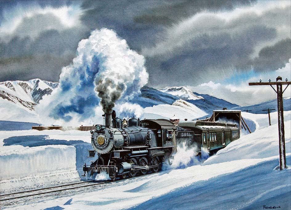
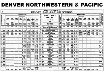
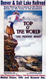
In 1902 the Denver Northwestern & Pacific Railway (DN&P) was formed, their president being one David H. Moffat, with the goal of connecting Denver and Salt Lake more directly. By 1913 their line ran west from Denver over Rollins Pass to Winter Park, Suphur Springs, Bond, then further northwest to Steamboat Springs and Craig. They never did reach Salt Lake. 1913 also found the railway bankrupt.
Forced into a reorganization, the railway re-emerged as the Denver & Salt Lake Railway (D&SL) . In 1931 the D&SL was acquired by the well known Denver & Rio Grande Western (DRGW) with the intention of connecting their mainline at Dotsero to the D&SL thereby providing a direct link from Salt Lake City to Dotsero then Denver through the Moffat Tunnel which had opened in 1928. The DRGW began construction of this new shortcut near Bond to connect with Dotsero. This nearly 40 mile connection which was completed in 1934 became known as the Dotsero Cutoff.
When constructed the Dotsero Cutoff began at mileage zero, hence the name Dotsero, then continued east to Orestod, which is Dotsero spelled backwards, near Bond. Along the Cutoff the tracks follow the Colorado River through some of the prettiest scenery in the United States of America. Today's trackage continues east from Orestod through Kremmling, Hot Sulphur Springs, and Tabernash reaching Winter Park where the west portal of the Moffat Tunnel lies. From the east portal of the Moffat Tunnel it's downhill all the way to Denver.
The DRGW was taken over by the Southern Pacific Railroad (SP) in 1988 which was subsequently acquired by the Union Pacific Railroad (UP) in 1996. Other than the Rollins Pass section, all of the original DN&P-D&SL route is still in use today by the UP.
The photos attached to this short story were taken between 5 and 6 Sep 2006 during an exploration drive along the Dotsero Cutoff and the old Denver & Salt Lake Railway, now the Union Pacific Railroad. Unfortunately, major track work with long work blocks for construction near Glenwood Springs restricted the number of trains traversing the route.
Commencing at Interstate Highway number 70, eighteen miles east of Glenwood Springs, there is a two-lane paved road that parallels the railway tracks for the most part, and the Colorado River along the route. Driving east from this point the road took me through Derby Junction, Dell, Orestod, Bond, Yarmony, Kremmling, Troublesome, Parshall, Hot Sulphur Springs, Granby, Tabernash (Some Anglais must have created this bastardized French-Canadian cuss word.), Fraser, and finally the west portal of the Moffat Tunnel at Winter Park.

One interesting area is located near Dell where there's a lot of iron oxide buried in the land colouring the hillsides with a rich orange texture in certain places. The crystal clear Colorado River cuts through a landscape dotted with small pine trees and sagebrush. This may be a good fishing spot as two men were spotted preparing to launch a small boat from a campsite beside the river. This is the route for Amtrak's California Zephyr which connects Chicago, Omaha, Denver, Salt Lake City, and San Francisco. Their silver and blue General Electric Dash 9-P42B units were photographed pulling at least 8 of their distinctive double-deck Superliner passenger cars westbound at this point.
Moving farther to the east, the Craig Branch line coming south from Yampa joins the railway at Bond where there is a small yard and passing siding. Yarmony lies still further to the east in country similar to that mentioned earlier but there are less traces of iron oxide colouring the land. East of Yarmony the road separates from the railway and river to take the higher elevation and enters Kremmling from the south bypassing Radium and Azure. Dead-end side roads lead to these places down in the valley but they weren't explored.
After an overnight stay in Kremmling the next morning the railway was located again near the end of town. The country here is flat with hills rising in the distance. An Austrian built welding machine built by Plasser and crew were waiting in the passing siding at Troublesome for an eastbound freight train to clear so they could get back to work. If desired, this machine is capable of welding CWR (Continuous Welded Rail) from jointed rail sections.
Taking advantage of this information I raced ahead to Parshall to photograph the eastbound. Parshall is nestled in low hills covered with scrub brush looking like model railroad bushes made of lichen. Eastbound, UP 6298, obliged in a timely fashion and was headed by a unit still in Southern Pacific livery while the pusher DPU (Distributed Power Unit), wore the familiar Union Pacific colours.
Still farther east, Byers Canyon lies about halfway between Parshall and Hot Sulphur Springs. This rugged canyon is occupied by both roadway and railway which twist and turn through the canyon beneath jagged peaks towering over the whole scene. Two westbound trains arrived while waiting for photographs. Incredibly, the first had eight UP locomotives on the head-end. Shortly after this train came the California Zephyr with it's Superliner consist once again on it's daily trip across America from Chicago to the west coast.
Travelling on, UP 6298 East, that SP livery, was photographed whistling through Granby at permissible track speed. Expecting to photograph it later entering the Moffat Tunnel I raced ahead to locate the west portal at Winter Park. Once on-site there ensued a long wait, but the train didn't show up. In fact, several hours passed without a train visible anywhere.
At this point the two day exploration was abandoned for a trip over Berthoud Pass at 11,307 feet elevation to rejoin Interstate Highway 70 and reach Georgetown. That night I had a splitting headache all night long. Did the 11,307 foot Berthoud Pass or Georgetown, at an elevation of only 8,500 feet, cause the altitude sickness? Who knows, but the drive begun at Dotsero was certainly worth the trip.
