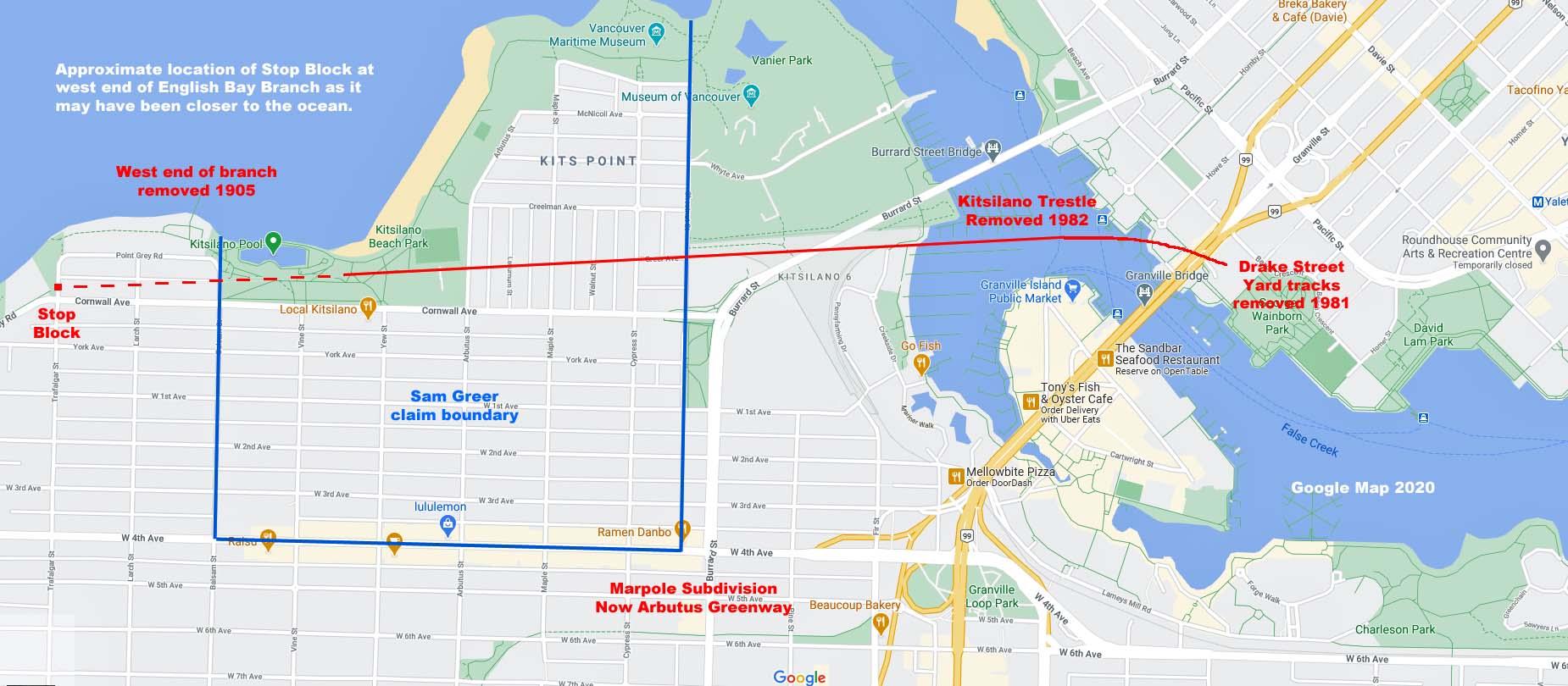
A Google map with additions showing the APPROXIMATE location of Sam Greer's proprty boundary and a portion of CPR's English
Bay Branch line - 2020 Google. "Plans filed by CPR in 1886 with the Department of Railways show the English Bay Branch running westwards in a
straight line to what is now known as Kitsilano Beach and then running along the south shore of English Bay for a further half-mile or so to about the
north foot of the present Trafalgar Street. It seems that the line running from the trestle to Trafalgar Street may never have carried more than one
CPR train and that the line west of Kitsilano Beach was effectively abandoned soon after being built. The straight section running across Kitsilano
Point to Kitsilano Beach, after years of disuse, was leased in 1905 to the B.C. Electric Railway Co. (B.C.E.R.) which used it until about 1948 as the
route of its No. 12 streetcar line which ran from downtown Vancouver across the trestle to Kitsilano Beach." - Court of Appeal for British Columbia
Docket: CA027336/CA027337.


