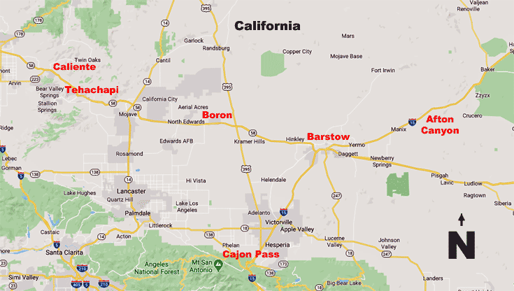
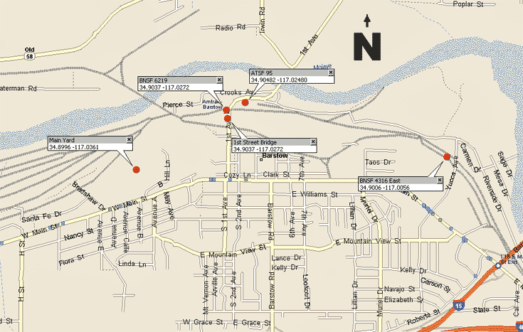
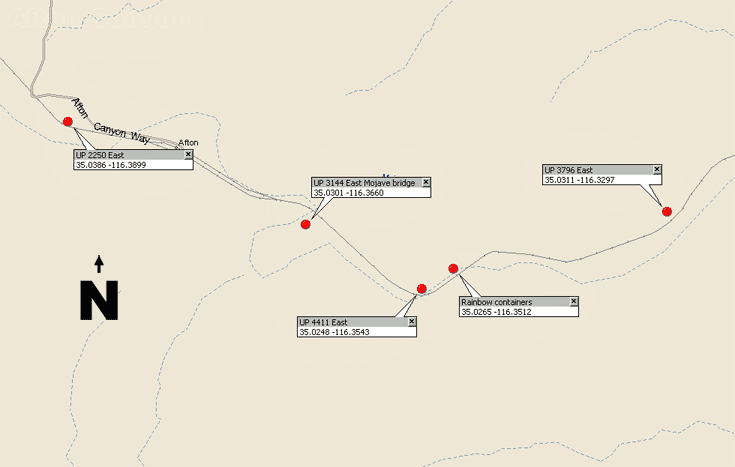
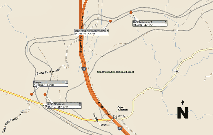
This base map shows the location of the main sites visited and photographed along the railroad lines fanning out from Barstow to the Northwest, Northeast, and Southwest.
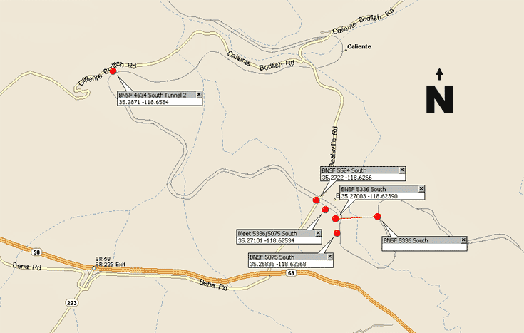
Caliente lies about 8 1/2 miles to the west of Tehachapi Loop. Look for the Caliente Road sign as you travel on Highway 58. Bealville Road leads steeply down the hill to the railway grade crossing at Bealville then further down to the lower railroad horseshoe curve at Caliente. Tunnel Two is accessed via the Caliente Bodfish Road.
Every railfan in the world must have heard of the Tehachapi Loop by now. The Tehachapi Pass area is perfect for photographs but photos can't convey the elevation of the pass. Photos show what appear to be gentle rolling hills but in fact trains using the Pass climb upgrade from a flat plain at Bakersfield nearly 3,500 feet to reach the summit in a slow tortuous ascent through tunnels, across several bridges, around tight horseshoe curves, and of course the 360 degree circle of Tehachapi Loop itself.
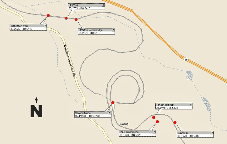
You should take a look at this satellite photograph from Google Maps to view changes in the route. You'll notice that the line beside Tunnel 10 is now double-track all the way to the east switch at Marcel. Looking at the present track plan of the Loop area one wonders why the railway didn't bore a second tunnel at Walong and continue double-tracking westwards to Woodford next siding. It would entail the construction of two more bridges as well so perhaps the cost is prohibitive at this time.
The Tehachapi Loop is the crowning achievement of civil engineer William Hood of the Southern Pacific Railway Company. Under the leadership of J.B. Harris, Chief of Construction, 3,000 Chinese laborers from Canton, China, helped to complete the track in just 2 years time between 1874 and 1876.
An uphill train first passes through an entry tunnel then does a complete counterclockwise loop, passing again over the entry tunnel before continuing up the Tehachapi Pass. The loop is 3,799 feet long with a typical diameter of about 1,210 feet. With modern freight trains, often more than a mile long, the locomotive passes 77 feet over (or under, depending upon direction) the last cars of its own train!
The line was part of the final link of the first railroad connecting San Francisco to Los Angeles. Approximately 36 freight trains pass every day and the Tehachapi Loop remains one of the seven wonders of the railroad world.
Tehachapi Loop
Tehachapi Loop lies at Walong (WAY-long) between Woodford siding on the north and Marcel siding to the south. That's railroad north and south, not geographic north and south. Trains travelling towards Bakersfield from Los Angeles are designated northbound and vice versa. The City of Tehachapi townsite is located approximately 8 miles south of the Loop at the summit of the pass. Access to Tehachapi Loop is best from Highway 58 using the Keene exit. You then follow the twisting, turning, and narrow Woodford Tehachapi Road uphill to reach the Loop. The Loop may also be accessed from Tehachapi town through the same road but it is a much longer route, although very scenic.
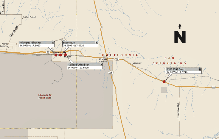
Several photos were taken in the area of Boron enroute to Barstow. A BNSF Maintenance of Way train found here was loading ribbon rail onto special flatcars specifically designed to transport the long sections of CWR (Continuous Welded Rail).
Barstow lies at the center of the giant X of rail lines. There are two yards located there. The main yard containing a hump and locomotive servicing facility is located west of First Street. A smaller flat yard is located just east of First Street by the Amtrak station and Western America Railroad Museum.
Afton Canyon lies about 40 miles east of Barstow along Highway 15. Look for Afton Canyon Way, which leads south of Highway 15 to the canyon. This is a gravel road in rough shape. A 4x4 vehicle is recommended for travel in the canyon. Fording of the Mojave River may be required. Depending on the season the river may be impassible.
The heaviest traffic flow seems to follow the route from Los Angeles through Cajon Pass to Tehachapi and Caliente. Colton Yard is a crew change point in Los Angeles with Bakersfield at the opposite end west (railway north) of Caliente. The California Southern completed the first track through Cajon Pass in 1885 . The California Southern was a subsidiary of the Atchison Topeka & Santa Fe (ATSF). The Cajon Pass line later became the Santa Fe's mainline
 between Los Angeles and Chicago.

